IELTS · Guides · October 24, 2026 · 4 min read
IELTS Writing Task 1 map: how to describe changes to a place, with a sample answer
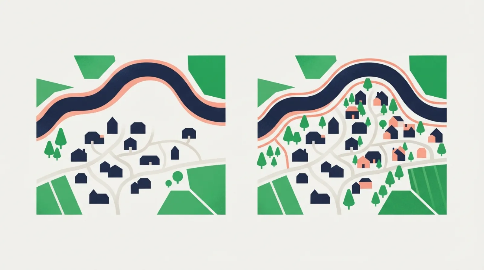
A Task 1 map usually shows the same place at two points in time: a village in 1990 and today, a park before and after redevelopment, or a town now and a plan for the future. Sometimes there is only one map with two possible sites for a new building. Either way, there are no numbers. You describe what changed and where, and the overview sums up the overall direction of the change.
Before you write
- Find the compass and the scale. North is usually up. Describe positions with north, south, east, west, or in the top right-hand corner.
- List the changes under three headings: added (new buildings, roads, a car park), removed (trees cut down, a factory demolished), converted (a farm turned into housing). Note what stayed the same, too.
- Find the overall direction. More developed? More residential? Less green? More tourist-friendly? This goes into the overview.
- Split the details by area (the north and the south of the town) or by type of change (what was removed, then what was added).
Language for maps
Changes, usually in the passive:
- was built / was constructed / was added
- was demolished / was knocked down / was removed / was cut down
- was converted into / was replaced by / was turned into
- was extended / was expanded / was widened / was relocated to
Location:
- to the north of the river, in the south-east corner, on the western edge of
- next to, opposite, alongside, between the school and the station
- where the farmland used to be, on the site of the old factory
Tense: past simple and passive for past maps (was built), present perfect when the second map is today (has been replaced), future forms for plans (will be built, is planned).
A model answer
Task: The maps below show the village of Westbrook in 2000 and in 2025. Summarise the information by selecting and reporting the main features, and make comparisons where relevant.
In 2000, the village had a main road running north to south, a school and a few houses west of the road, farmland to the east, a small shop in the centre, a forest in the north-east and a river along the southern edge. By 2025, a housing estate has replaced most of the farmland, the shop has become a supermarket with a car park, the school has a new sports field, a cycle path runs along the river in the south, and the forest is smaller.
The maps illustrate how the village of Westbrook changed between 2000 and 2025.
Overall, the village became considerably more developed and residential over the period, with much of its farmland and part of the forest giving way to housing and services. The main road and the school, however, remained in the same places, and the river still formed the southern boundary.
The most significant change took place to the east of the main road, where most of the farmland was replaced by a large housing estate. Part of the forest in the north-east was also cleared, although a smaller area of woodland survived.
In the centre of the village, the small shop was converted into a supermarket, and a car park was built next to it. On the western side, the school remained but was given a new sports field. Finally, a cycle path was added along the river in the south of the village, which had no paths in 2000.
161 words. The overview names the general direction (more developed and residential) and one thing that did not change.
Common mistakes
- Describing the first map, then the second. Compare as you go: the farmland was replaced by…
- No overview. “The village became more developed” is the sentence the examiner is looking for.
- Mixing up directions. Check the compass before writing north or east.
- Active verbs that suggest who did it: The government built a supermarket adds information the map does not show. Use the passive.
- Missing a change. Tick off each feature on both maps as you write about it.
Practise
Write the model task above in 20 minutes, then try a pair of maps in the practice room. The AI examiner gives a band for each criterion and checks that the overview sums up the main changes and that the changes match the maps:
- Changes to a village: farmland and woodland give way to houses, a park and a school
- Tourist facilities on an island: before and after development
- A town centre: a factory, a car park and a market turned to new uses
- A university campus: new buildings on green space and parking
- Writing Task 1 guide: the general structure
- Process diagrams, the other non-chart task
Common questions
What if there is only one map? Usually it shows two possible sites for something new. Describe both sites and compare them, for example by distance from the town centre or access to roads. Do not say which is better unless the task asks.
How many changes should I describe? All the important ones. Small details, such as a single tree, can be left out.
Can I use “you”? No. Write about the place: visitors entering from the south would find… rather than you go in and turn left.
Also in Türkçe, Tiếng Việt